Meeting points

OurTrips
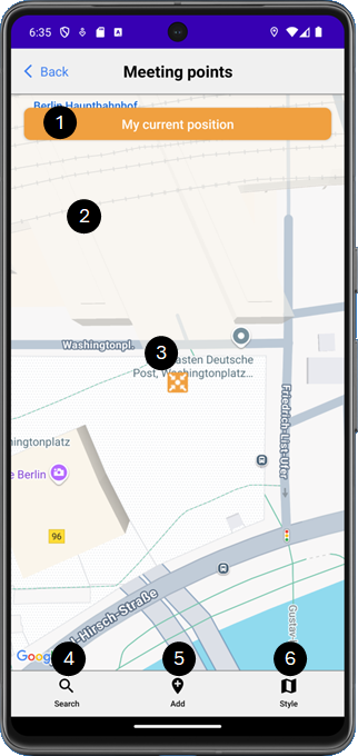
The orange marker marks the position of a new Meeting point on the map.

Tap the orange button to center the map around the orange “Meeting point” marker.

Tap on any point on the map to position the orange “Meeting point” marker at this point. If this position corresponds to an address, this address will be displayed on the orange button, otherwise its GPS coordinates will be displayed there.

Tap and hold the orange marker to move it to a new position. If this position corresponds to an address, this address will be displayed on the orange button, otherwise its GPS coordinates will be displayed there.

Tap on the “Search” icon to open the search dialog.

Tap on the “Add” icon to open the add dialog.

Tap on the “Style” icon to change the style of the map.
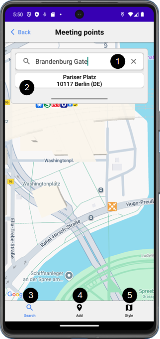
Enter the address or destination you are looking for here, e.g. “Brandenburg Gate”.
The addresses matching your search term are displayed here. Tap on an address to position the orange marker at this address.
Tap on the “Search” icon to close the search dialog.
Tap on the “Add” icon to open the add dialog.
Tap on the “Style” icon to change the style of the map.
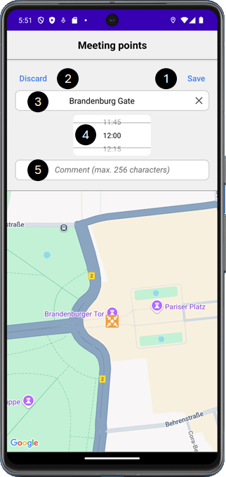
Tap on “Save” to create the new Meeting point and close the dialog.
Tap on “Discard” to discard your entries and close the dialog.
Enter the name of the Meeting point here.
Please note! If you have previously carried out a search, the name is pre-assigned with the search term.
Select the desired time here.
Enter a comment about the Meeting point here if required.
Please note! The address (or GPS coordinates) of the Meeting point are copied to the clipboard when the add dialog is opened and can therefore be pasted directly into the comment field.
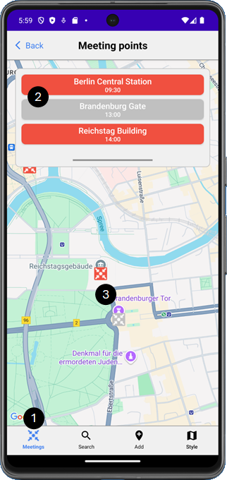
Tap on the “Meeting” icon to open or close the list of Meeting points.
Please note! This icon is only available if at least one Meeting point has been created.
In the list, all Meeting points created are displayed in chronological order, the active ones in red, the inactive ones in grey.
Tap on a Meeting point in the list to center the map around this Meeting point and display its detailed information.
All created Meeting points are displayed on the map with markers, the active ones in red, the inactive ones in gray.
Tap on a marker to display its detailed information.
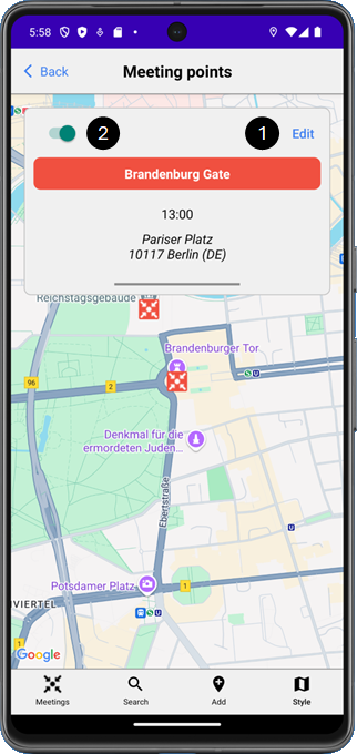
Tap on “Edit” to change the Meeting point information.
Deactivate the Meeting point if it should not or no longer be displayed to the participants.
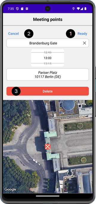
Tap on ‘Ready’ to save your changes and close the dialog.
Tap on ‘Cancel’ to discard your changes and close the dialog.
Tap on ‘Delete’ to delete the Meeting point.
Please note! This option is not available during a trip.